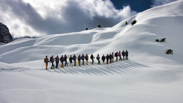
Hiking in Styria
Automatically saved draft
At the end of the winter season, we head up high: on the way by public transport, we experience two magnificent hikes on the Dachstein plateau.
Hiking through the snow-covered karst landscape of the extensive Dachstein plateau is certainly one of the most impressive snowshoe experiences. Starting from the Dachstein-Krippenstein, there are three marked - short and technically easy - snowshoe trails: to the Five-Fingers, the World Heritage Spiral and the Dachstein Shark.
Facts & Figures
- Hiking data: 1st tour (Heilbronn circular trail): 8 km / 300 m elevation gain / walking time approx. 3.00 h
2nd tour (Wiesberghaus) 10 km / 450 m elevation gain / walking time approx. 3.30 h - Requirements: From groomed trails to technically difficult passages; off-trail orientation is difficult; digital navigation is an advantage.
- Starting point: Arrival via Obertraun-Dachsteinhöhlen train station, bus 543 to Obertraun Dachstein cable car or approx. 30 minutes on foot.
- Refreshment stops: Mountain restaurant Dachstein Krippenstein, Gjaid Alm, Naturfreundehaus Wiesberghaus, Simonyhütte, Dachsteinbuffet
- Questions and suggestions: WEGES - Silvia and Elisabeth, 0650/2611119, weg-es.at, Facebook, Instagram and YouTube: wegesaktiv
In addition to these attractions, we are impressed by the doline landscape and the view of the glaciers and the Hohe Dachstein. If you want to take it all in, you should take two days, travel by public transport and go on the recommended snowshoe tours, which require high alpine experience and appropriate equipment.
The first hike takes us from the cable car mountain station downhill to the left across the ski slope, where we follow the marked winter hiking trail to the Dachstein shark. Now we leave the marked trail and follow the wooden poles to the Heilbronner Kreuz (1959 m). Continue on the Heilbronner circular hiking trail via the Hirzkaralm to the Gjaid station (1788 m). The wooden poles are merely an orientation aid, so you can adapt the route to suit your individual needs.
The second hike from the Gjaid Alm (1739 m) via the prepared path (Dachstein crossing ski route) to the Wiesberghaus is relatively easy. After approx. 3 km, we leave the main trail to turn right onto the "Artillerieweg" - which is usually groomed by a Ski-Doo - to the Wiesberghaus (1872 m). The way back is via the ascent route, although a more challenging variant via the Bärengasse would be an alternative.


Da dieser Artikel älter als 18 Monate ist, ist zum jetzigen Zeitpunkt kein Kommentieren mehr möglich.
Wir laden Sie ein, bei einer aktuelleren themenrelevanten Story mitzudiskutieren: Themenübersicht.
Bei Fragen können Sie sich gern an das Community-Team per Mail an forum@krone.at wenden.