Hiking in Styria
On the sunny side to the Triebenstein summit
Elisabeth Zienitzer and Silvia Sarcletti recommend: A sporty spring hike in the Mur Valley to the 1810-metre-high Triebenstein - an impressive summit.
If you want to test your fitness and surefootedness right after winter, you should climb the Triebenstein at 1810 meters. This inconspicuous peak, which is part of the Rottenmanner Tauern, has it all. The ascent is steep and sunny, but it is definitely worth the effort, as the summit towers high above Hohentauern and offers a breathtaking panorama. By the time you see the idyllic lake pass landscape of Hohentauern, the effort is forgotten and what remains is the joy of exercise in nature. Our conclusion is this: a worthwhile summit tour in spring!
Data & facts
- Hiking data: 5 kilometers/ 550 vertical meters/ walking time approx. 2.5 hours
- Requirements: A very steep hiking trail that should be avoided in snow and wet conditions. There are pale markings and signposts, so it is important to pay attention to these. All in all, a very sporty route.
- Starting point: Passhöhe parking lot in Hohentauern
- Refreshment stops: Alpenhotel Lanz, 03618/347; Tauernwirt, 0676/6103583; Restaurant Passhöhe, 03618/219, Keltenstüberl, 0660/3294035
- Questions and suggestions: WEGES - Silvia and Elisabeth, 0650/2611119, weg-es.at, Facebook, Instagram and YouTube: wegesaktiv
We start at the Passhöhe parking lot in Hohentauern (1274 m) and walk left along the mining road. At the first junction, we walk slightly uphill to the right, following the asphalt road, which leads into a forest path. Immediately after entering the forest, we see the yellow signpost in the direction of Triebenstein.
The route continues gently uphill along the forest road until the path begins on the left, which leads more or less in a steep uphill line. After a long left-hand bend, we reach a clearing (1600 m) where the entrance to the forest can be seen at the very top. After the tree line, we reach the last rocky section and the ascent to the summit. This section in particular requires surefootedness and a head for heights and should be avoided in snow and wet conditions.
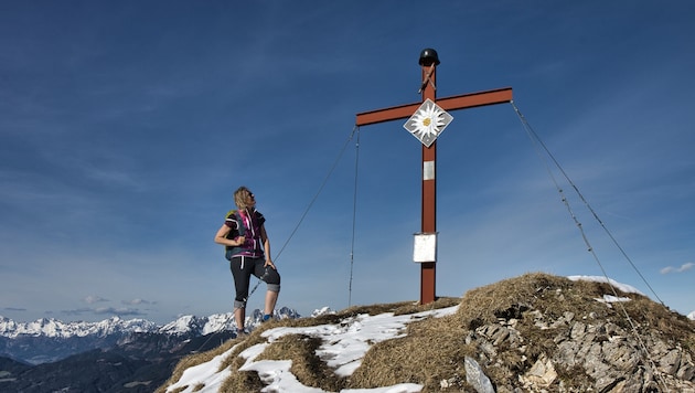
Once we reach the Triebenstein (1810 m), a red summit cross, a magnificent 360-degree mountain panorama and a view of Hohentauern with its lakes, which is literally at our feet, await us. The way back is via the ascent route.


Da dieser Artikel älter als 18 Monate ist, ist zum jetzigen Zeitpunkt kein Kommentieren mehr möglich.
Wir laden Sie ein, bei einer aktuelleren themenrelevanten Story mitzudiskutieren: Themenübersicht.
Bei Fragen können Sie sich gern an das Community-Team per Mail an forum@krone.at wenden.