HIKING IN STYRIA
A hike from the cathedral to the tower
From Seckau to the Tremmelberg - this hike combines culture and nature in the Murtal region on a variety of paths.
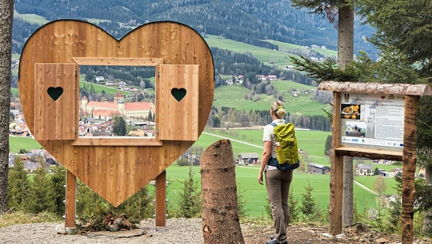
A "new" hiking trail leads through the municipality of Seckau and impresses in many ways. Along the way, there are beautiful rest and information points with information boards and artistically restored wayside shrines that invite you to linger.
DATA & FACTS
- Hiking data: 8.8 km / 380 m elevation gain / walking time approx. 3 h.
- Requirements: on asphalt and gravel roads to the start of the hiking trail; through the forest via steep paths and forest roads to the Tremmelberg.
- Starting point: parking lot in the center of Seckau; near the ADEG grocery store.
- Refreshment stops in Seckau: Gasthof zur Post, 03514/5247; Restaurant Hotel Hofwirt, 03514/54290, Café Konditorei Regner, 03514/5207.
- Questions and suggestions: WEGES - Silvia and Elisabeth, 0650/2611119, weg-es.at, Facebook, Instagram and YouTube: wegesaktiv.
The destination of the hike is the Tremmelberg, with the 42-metre-high observation tower "Turm im Gebirge", which is accessible via a turnstile with a 2-euro coin and has now reopened after renovation work.
From this popular excursion destination, we enjoy the magnificent view of Knittelfeld and the mountain regions of the Seckauer Tauern and Seetal Alps as well as the ridges of the Styrian Randgebirge. Time should be planned for the town of Seckau, as the Benedictine abbey, the Regner confectionery and the local inns are known far beyond the borders and round off the hike harmoniously. Conclusion: a trilogy of enjoyment, culture and nature.
We start in Seckau (843 m) and walk through the village - past the Regner confectionery - to the Färberkreuz, a striking wayside shrine at a crossroads.
Here we keep left and continue straight ahead until we reach a stream and a parking lot for hikers (few parking spaces). From here, the ascent begins, following the red-white-red markings. The path leads past wayside shrines, numerous information boards and rest areas, continuously uphill.
At the Mylius cross, we continue to the left until we reach the Calvary Church (1191 m) in a clearing and a little later the Tremmelberg (1194 m) with its viewing tower.
The way back is via the ascent route.


Kommentare
Da dieser Artikel älter als 18 Monate ist, ist zum jetzigen Zeitpunkt kein Kommentieren mehr möglich.
Wir laden Sie ein, bei einer aktuelleren themenrelevanten Story mitzudiskutieren: Themenübersicht.
Bei Fragen können Sie sich gern an das Community-Team per Mail an forum@krone.at wenden.