Innkeeper as spy
Border dispute more than 500 years old not over
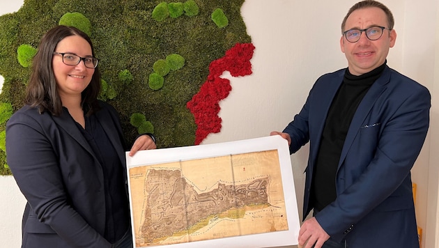

The sometimes bizarre course of the border between Burgenland and Styria, including its curious protrusions, has long been a mystery. A pair of teachers are now revealing many old secrets. A very special role was once played by inns, which were built as a kind of bastion in hotly contested areas. Innkeepers were almost like scouts and spies because they could find out everything.
 Kronen Zeitung als bevorzugte Google-Quelle hinzufügen
Ulrike and Thomas Hochwarter from Litzelsdorf in the Oberwart district took a close look at 110 kilometers from Sinnersdorf in Styria and Pinkafeld in Burgenland to the Mur near Murska Sobota. "Our hometown with 1140 inhabitants has two Anger, west and east of the Strem. That made us wonder, as did the name Stadtgraben," recalls the teacher couple. In addition, they discovered a number of maps, some of which show the bizarre borders between today's Burgenland and Styria.
Exciting research
The professors investigated: "When King Ludwig II ceded the reign of Güssing to the Hungarian noble family Batthyány in 1524, the new rulers began to expel the Styrians east of the Lafnitz - first with words, then with weapons." Turkish wars and the Kuruc Crusades were added to the mix. Many territories were hotly contested. In the 18th century, monarch Maria Theresa finally turned the tax system upside down. Nobles had to have their estates assessed - including heated feuds. Later, under Joseph II, the country's borders were surveyed again with improved technology and specially appointed commissions, but the border conflict on the Lafnitz never came to rest.
Lines defined
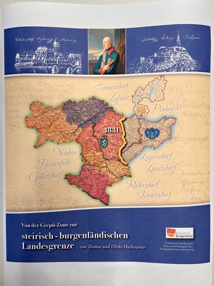
The situation came to a head during the revision of the so-called Franziszeische Kataster. Hungary was called upon to clarify the borders around the kingdom - including those to Styria - and sent out commissioners. Count Stubenberg determined the lines for Styria, Count Festetits for Hungary. Both asked the Emperor in Vienna for confirmation - Sinnersdorf, Neudauberg, Burgauberg, Hackerberg, Stinatz and the western half of Litzelsdorf were to belong to Styria.
But this decision took time - the farmers became restless due to the double taxation and resorted to violent methods. "Where it was unclear to whom the land belonged, loyal Hungarian subjects built inns as bastions. The innkeepers were aware of everything, they probably knew all about many secret things and local events," says Thomas Hochwarter.
Turmoil around Sinnersdorf
The events of the 1848 revolution blurred the traces of the demarcation of the border - but by 1857, the western border of today's southern Burgenland was largely clarified. Sinnersdorf became part of Styria, while the remaining municipalities remained with Hungary.
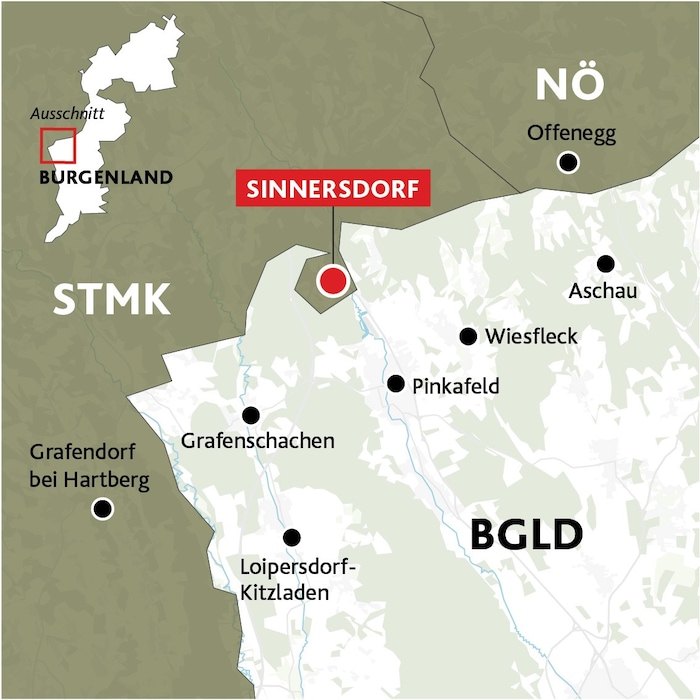
To this day, the consequences of more than 500 years of border disputes have not been completely resolved. For example in church matters. Sinnersdorf is still looked after by the Catholic parish of Pinkafeld. On the other hand, Burgenlanders from Burgauberg are buried in Burgau in Styria.
Presentation at elementary school
All the findings from the research and some unpublished maps will be presented by the teacher couple on Saturday at 6 pm at Litzelsdorf elementary school - summarized in the book "From the Gyepű zone to the Styrian-Burgenland border". Order for €35 plus shipping by email at office@bm-hochwarter.at.
Apropos Gyepű: Uninhabited areas between estates were a border protection system of the Hungarians in the Middle Ages. Ancient Styrians used the buffer zone in certain sections and settled there without greed.
This article has been automatically translated,
read the original article here.










Da dieser Artikel älter als 18 Monate ist, ist zum jetzigen Zeitpunkt kein Kommentieren mehr möglich.
Wir laden Sie ein, bei einer aktuelleren themenrelevanten Story mitzudiskutieren: Themenübersicht.
Bei Fragen können Sie sich gern an das Community-Team per Mail an forum@krone.at wenden.