Hiking in Styria
Snow-covered summit dreams lie above Altaussee
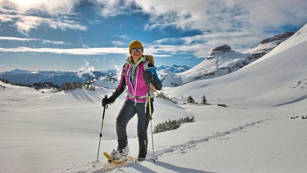

We take the new panoramic cable car to the Loseralm and snowshoe along deep winter paths to the Schwarzmoossattel. This is the hiking tip of the week from Elisabeth Zienitzer and Silvia Sarcletti.
 Kronen Zeitung als bevorzugte Google-Quelle hinzufügen
 The striking Loser, Altaussee's imposing summit landmark, attracts everyone's attention in both summer and winter. This mountain landscape with its extensive limestone plateau lies on the south-western edge of the Totes Gebirge and offers an ideal snowshoeing area with small-scale structures. During the ascent with the new panoramic cable car and still at the starting point of our hike, there is a lot of hustle and bustle, but after a short time we literally "leave it behind us".
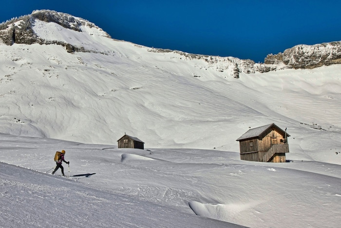
A winter landscape dominated by dolines and mountain pines stretches out before us, with numerous snowshoe and ski touring tracks visible. These tracks provide basic orientation, as signposts and markings are often hidden under the snow cover. What is an easy snowshoe tour in good visibility can be challenging in fresh snow or fog and can sometimes lead to considerable orientation difficulties. Caution is therefore advised.
Data & facts
- Hiking data: 6.4 km / 400 m / walking time approx. 3 h.
- Requirements: easy terrain with steeper sections; orientation difficult in poor visibility.
- Arrival by public transport: Ski bus from Bad Aussee train station to the Loser-Bergbahnen valley station.
- Loser cable cars: Ascent and descent (29 euros) for snowshoe hikers.
- Starting point: mountain station / Loseralm.
- Refreshment stops: none during the hike; several within the ski area.
- Questions and suggestions: WEGES - Silvia and Elisabeth, 0650/2611119, weg-es.at; Facebook, Instagram and YouTube: wegesaktiv.
What many people don't know: The name Loser comes from the Middle Ages, when the people of Aussee climbed to the summit to "losen" - in other words, to listen for the sound of battle in the distance. Conclusion: listen to your inner voice and only set off on the tour if the conditions allow it.
The hike starts at the mountain station (1600 m) and goes up behind the building along the edge of the slope. At the first left-hand bend, we see a wind vane, which we head towards. Passing the head stations of the currently closed lifts, we reach the Bräuningalm (1609 m) with its many huts. We keep to the left of the large areas of mountain pines and choose the best track to the Schwarzmoossattel, our destination (1684 m).
This article has been automatically translated,
read the original article here.










Da dieser Artikel älter als 18 Monate ist, ist zum jetzigen Zeitpunkt kein Kommentieren mehr möglich.
Wir laden Sie ein, bei einer aktuelleren themenrelevanten Story mitzudiskutieren: Themenübersicht.
Bei Fragen können Sie sich gern an das Community-Team per Mail an forum@krone.at wenden.