Project from Austria
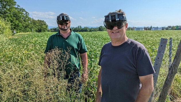
On the smart field with mixed reality glasses
Augmented or mixed reality (AR), which overlays reality with additional digital information, is now also finding its way into agriculture. Using satellite data and AR technology, local researchers have developed software to analyze fields on the spot with the help of AR glasses. This type of visualization can be used to optimize irrigation, for example, said project leaders Matthias Husinsky from the St. Pölten University of Applied Sciences (FH) and Francesco Vuolo from the University of Natural Resources and Life Sciences (Boku) Vienna.
The software has created a bridge between the satellite data and the reality in the field: "The direct visualization of data in the field using AR - whereby real conditions are merged with abstract, digital information - accelerates the process of gaining understanding enormously and will be available to everyone in the future using AR glasses," explained Husinsky. This will make it easier to assess agricultural problems and challenges.
Many possible applications
For example, the AR prototype can be used to compare one field with the neighboring one. But specific things such as the amount of irrigation - up to a week in advance - can also be monitored, explained Vuolo, who came up with the idea for the research project. This would make work in the field "more efficient and more precise than ever before". It also saves resources, which benefits agriculture on the one hand and the environment on the other, said the Boku project manager.
It will still take some time before it is ready for the market
It will take around five to ten years before farmers can use the software - the goal is market maturity, according to Husinsky. The use of AR should also be profitable for smaller farms, as the costs would be significantly lower compared to conventional analysis tools.
A follow-up project is already planned to drive forward the further development of the AR prototype. AR and drone flights could then be used to monitor plant diseases or reduce accidents caused by unsafe soil conditions in alpine agriculture. The UAS project manager also sees potential in the documentation of data in the field - especially with regard to climate change, which is leading to changes in agriculture. It could also be used in the construction industry, landscape planning or in archaeology with georeferenced data.


Kommentare
Da dieser Artikel älter als 18 Monate ist, ist zum jetzigen Zeitpunkt kein Kommentieren mehr möglich.
Wir laden Sie ein, bei einer aktuelleren themenrelevanten Story mitzudiskutieren: Themenübersicht.
Bei Fragen können Sie sich gern an das Community-Team per Mail an forum@krone.at wenden.